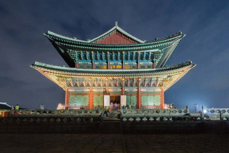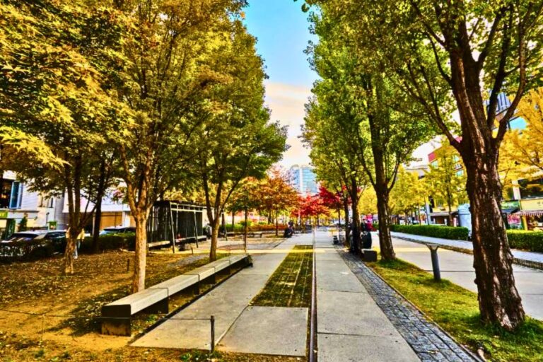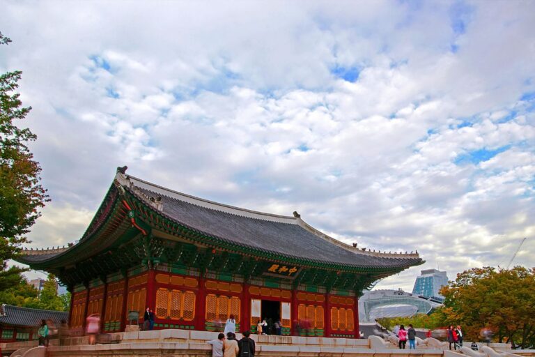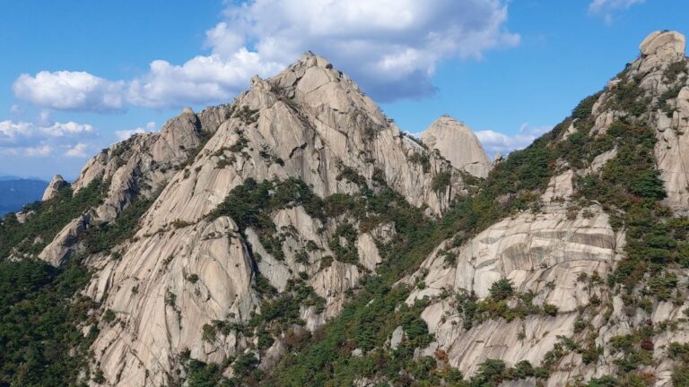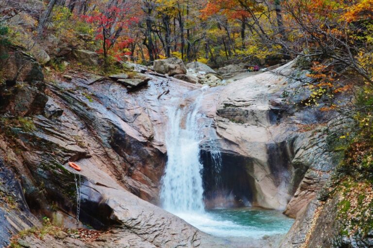

Approximately 25% of Seoul’s total land area is mountain. For a city of ten million people, that number is almost absurd — and almost no one outside Korea knows it before they arrive.
Every one of those mountains is free to enter. Most of them are accessible from a subway station. None of them require a reservation, a rental car, or a guided tour. You can be standing on a granite ridge above the Seoul skyline within ninety minutes of leaving your hotel.
According to an analysis by the Seoul AI Foundation published in July 2026, foreign visitor numbers at Seoul’s major hiking trails rose 9–12% year-on-year in 2025. Over 70% of visitors to the Bukhansan Hiking Tourism Center are now foreign nationals. Achasan and Gwanaksan recorded the fastest growth of any Seoul destinations tracked. K-drama and K-pop brought people here. K-hiking is what they’re telling their friends about when they get home.
This guide covers the five mountains worth knowing. Each one offers something different — different difficulty, different scenery, different time commitment. Whether you’ve never hiked before or you’re looking for your second or third mountain on a longer trip, you’ll find the right one here.
Seoul Hiking Tourism Center — The Infrastructure That Makes Everything Easier
Before getting into the mountains themselves, one thing is worth knowing upfront.
Seoul operates a network of Seoul Hiking Tourism Centers specifically designed for visitors who want to hike without owning gear. Three centers are currently running — at Bukhansan, Bugaksan, and Gwanaksan — and between them they cover the mountains where the most foreign visitors end up.
What every center provides:
- Gear rental: hiking boots, trekking poles, backpacks, hiking clothes, crampons — ₩2,000–5,000 per item
- Free guided hiking programs with English and Japanese assistance (check schedule in advance)
- Trail maps and course information in English
- Website: seoulhiking.or.kr
| Center | Location | Closed |
|---|---|---|
| Bukhansan | 52 Samyang-ro 173-gil, Gangbuk-gu (5F) | Mondays |
| Bugaksan | 88 Samcheong-ro, Jongno-gu (1F) | Tuesdays |
| Gwanaksan | 23 Sillim-ro, Gwanak-gu — Gwanaksan Station B1 | Wednesdays |
Check seoulhiking.or.kr before visiting to confirm the day’s program schedule and center hours.
The 5 Mountains — What Each One Actually Offers
🏔️ Mountain 1 — Bukhansan (북한산) 836m
“The widest view of Seoul from any summit”
Difficulty: ★★★☆☆ Intermediate Time: 2.5–3.5 hours round trip (Baegundae Peak) Admission: Free
How to get there: Ui-Sinseol Line to Bukhansan Ui Station (북한산우이역) → 2km walk to Baegundae Visitor Center Line 3 to Gupabal Station (구파발역) → Bus 704 or 34 → Bukhansanseong Entrance
What only Bukhansan offers: This is Seoul’s highest accessible summit — the only mountain on this list where you climb genuine alpine granite to a peak above 800 meters. The approach moves through forest and past sections of a Joseon-era mountain fortress before transitioning to exposed rock. The final stretch before the summit uses fixed iron chains set into the granite face. You will use your hands. That’s the whole point.
From the top of Baegundae Peak, on a clear day, Lotte World Tower, Namsan Tower, and the full grid of Seoul spread out in every direction. The scope of the view — a megacity from above, seen from a wild granite summit — is the experience most people come back for.
The foreign visitor number tells the story: 70% of people who visit the Bukhansan Hiking Tourism Center are not Korean locals. No other capital city offers this particular combination so accessibly.
Essential tips:
- Hiking shoes with real grip are non-negotiable — wet granite in sneakers is dangerous
- Carry 1.5–2 liters of water per person; nothing is sold between the visitor center and the summit
- Weekday mornings before 9 AM are significantly quieter than weekend afternoons
- Finish with makgeolli (Korean rice wine) and pajeon (savory pancake) at a restaurant near the trailhead — this is the traditional K-hiking closing ritual
🏔️ Mountain 2 — Gwanaksan (관악산) 632m
“The mountain K-pop brought to the world’s attention”
Difficulty: ★★★☆☆ Intermediate Time: 3–4 hours round trip (Yeonjudae Peak) Admission: Free
How to get there: Sillim Line to Gwanaksan Station (관악산역) — Hiking Tourism Center is directly connected at B1 Line 2 to Seoul National University Station (서울대입구역) → 20–30 minute walk to trailhead
What only Gwanaksan offers: Of the five mountains, Gwanaksan recorded the fastest growth in foreign visitors between 2025 and 2026. The trigger: Boo Seung-kwan of K-pop group Seventeen posted a video of himself hiking here, and it circulated globally across K-pop fan communities. Travelers who had never thought about hiking in Seoul suddenly had a specific mountain on a specific continent in mind.
The summit — Yeonjudae Peak (629m) — sits on the site of a Goryeo Dynasty pavilion and commands views across southern Seoul, the Han River corridor, and on clear days toward Suwon. The ascent passes two Buddhist temples, Gwanaksa and Yeonjuam, both set into the mountainside and worth pausing at.
The 2026-renovated Hiking Tourism Center, directly connected to Gwanaksan Station at basement level, makes this the most logistically streamlined starting point of any mountain in this guide. Arrive by subway, rent gear downstairs, and start climbing.
Essential tips:
- The center at Gwanaksan Station (B1) is closed Wednesdays — check before going
- April brings azalea blooms across the lower slopes; one of the best mountain views of spring in Seoul
- After descending, the Sarosu-gil cafe street near Seoul National University Station is worth the short walk for a post-hike coffee and a seat in the shade

🏔️ Mountain 3 — Bugaksan (북악산) 342m
“Walk through Bukchon, climb to the view above Gyeongbokgung”
Difficulty: ★★☆☆☆ Beginner–Intermediate Time: 1.5–2.5 hours round trip Admission: Free
How to get there: Line 3 to Anguk Station (안국역), Exit 2 → walk through Bukchon Hanok Village → 16 minutes on foot to Bugaksan Hiking Tourism Center Or from City Hall or Gwanghwamun: Bus 11 → Samcheong Police Box stop
What only Bugaksan offers: Bugaksan is the most central mountain in Seoul — and the only one where the route to the trailhead passes through Bukchon Hanok Village, Seoul’s best-preserved neighborhood of traditional Korean tile-roofed houses. That 16-minute walk from Anguk Station isn’t just logistics. It’s its own experience. You combine a hanok neighborhood visit with a mountain hike without backtracking.
From the summit, Gyeongbokgung Palace and the Presidential Compound sit directly below you — an angle on these landmarks unavailable from any observatory or standard viewpoint in the city. The ridgeline follows a surviving section of the Hanyangdoseong, the Joseon-era city wall that once encircled the capital, and that section remains intact and walkable.
About 50% of visitors to the Bugaksan Hiking Tourism Center are foreign nationals — second highest of any center, after Bukhansan.
Important note: Some sections near the presidential compound may have restricted access due to security protocols. Always verify current trail access conditions on the official website or through your accommodation before visiting. Restrictions have been known to change.
Essential tips:
- Build the day around the Bukchon → Bugaksan → Gyeongbokgung sequence: hanok streets first, hike second, palace third
- Download the Hanyangdoseong app (iOS and Android) for walking guidance along the fortress wall sections
- This mountain lives and dies by visibility — skip it on fine dust days and come back when the sky is clear
🏔️ Mountain 4 — Achasan (아차산) 296m
“If you’ve never hiked before, start here”
Difficulty: ★☆☆☆☆ Beginner Time: 2–3 hours round trip (4.5–6 km depending on route) Admission: Free
How to get there: Line 5 to Achasan Station (아차산역), Exit 2 → 20-minute walk to trailhead Or Line 5 to Gwangnaru Station (광나루역) for a different entry point
What only Achasan offers: At 296m, Achasan is the lowest mountain on this list — and the most forgiving. A visitor from Singapore who had never climbed a mountain in his life wrote that Achasan “was possible.” That’s the accurate expectation to set: it’s a real hike with real elevation gain, but it’s achievable by anyone with reasonable fitness and a pair of decent walking shoes.
The payoff is specific and genuinely impressive: the Han River and Lotte World Tower seen from the ridge at sunset. As the light drops and the river turns golden, and Seoul’s skyline begins to glow against the dusk, this is one of the most accessible and under-photographed views in the city. Many visitors time their departure to arrive at the summit one to two hours before sunset specifically for this.
The mountain also carries historical significance — Goguryeo Kingdom fortifications from the 5th and 6th centuries are scattered across the hillside, with remnants of ancient earthworks and observation posts visible along the trail. On New Year’s Day, thousands of Seoul residents gather here at dawn to watch the year’s first sunrise.
Trail extension: From the summit, Naver Map can guide you onward along the ridge toward Yongmasan (348m) and Mangwusan (281m) — a longer route that connects into the Seoul Dulle-gil, the city-circling trail network.
Essential tips:
- Leave 1–2 hours before sunset to reach the summit with the best light
- The only mountain on this list where regular walking shoes are workable — but non-slip soles are still a good idea
- After descending, the area around Gwangnaru is known for soondubu jjigae (soft tofu stew) — the local post-hike dish
- No gear rental center here — no gear required for most visitors
🏔️ Mountain 5 — Inwangsan (인왕산) 338m
“Seoul’s city wall, a shamanist shrine, and the only mountain with an official night trail”
Difficulty: ★★☆☆☆ Beginner–Intermediate Time: Approximately 2 hours round trip Admission: Free
How to get there: Line 3 to Dongnimmun Station (독립문역), Exit 5 → walk straight toward Seodaemun Independence Park Or Line 3 to Gyeongbokgung Station (경복궁역) → toward Sajik Tunnel
What only Inwangsan offers: Inwangsan is the most distinctive experience on this list — the one that feels least like a standard hike and most like something specific to this city.
The entire ridge follows the Hanyangdoseong, the surviving sections of the Joseon-era Seoul city wall, which Seoul’s city government has illuminated with LED lighting along the full length. Walking it after dark means moving along a 600-year-old stone wall with the wall’s contours glowing against the sky, Gyeongbokgung Palace lit up in gold directly below you, and the city spread out on both sides. The view from this trail at night is Seoul Tower’s view — without the ₩20,000 ticket.
Inwangsan is the only one of these five mountains where night hiking is officially encouraged. In 2026, the city added upgraded LED lighting, smart emergency call stations at regular intervals, and improved footpath surfaces specifically to support evening use. Visitors report locals exercising and walking dogs here at 9 PM and later. Solo female travelers consistently rate it as safe.
In daylight, a different layer appears. Guksadang, a traditional shamanic shrine, sits halfway up the slope — one of the most accessible places in Seoul to encounter Korea’s indigenous shamanist tradition up close. The mountain has been associated with tiger legends and was the sacred space immediately outside the Joseon palace walls. That context shifts what you’re looking at when you walk the ridgeline.
Essential tips:
- Check air quality before going — this mountain’s entire appeal rests on visibility of Gyeongbokgung and the city below. Install AirVisual and check before you leave
- Some sections near the presidential area may have access policies — verify current conditions in advance
- The one-way route works well: Dongnimmun Station → city wall → Inwangsan summit → Gyeongbokgung Station descent. Takes about two hours, no backtracking
- Night visits: aim for late evening on a clear weeknight for the best combination of visibility and lighter crowds
Which Mountain Is Right for You?
| Mountain | Difficulty | Time | Best for | Signature experience |
|---|---|---|---|---|
| Bukhansan | ★★★☆☆ | 3–4 hrs | Summit seekers | 360° Seoul panorama from 836m granite |
| Gwanaksan | ★★★☆☆ | 3–4 hrs | K-pop fans, second visit | The mountain Seventeen’s Seungkwan made famous |
| Bugaksan | ★★☆☆☆ | 2 hrs | History, culture | Gyeongbokgung Palace directly below |
| Achasan | ★☆☆☆☆ | 2 hrs | First-timers, families | Han River sunset from the ridge |
| Inwangsan | ★★☆☆☆ | 2 hrs | Night experience, history | LED city wall walk with palace views |
Where to start: If this is your first Seoul mountain, go to Achasan. Second mountain: Inwangsan or Bugaksan. Once you want a summit and a genuine climb: Bukhansan. If K-pop is part of why you’re in Seoul: Gwanaksan.
Tips That Apply to All Five Mountains
① Use Naver Map — Not Google Maps
Google Maps does not support hiking trail routing in South Korea due to local mapping data restrictions. Naver Map (available in English) and KakaoMap both show accurate trail paths, section-by-section time estimates, and real-time trail closure notifications. Download one of these before you leave your accommodation. This is not optional — it’s the difference between finding the right path and spending forty minutes on the wrong one.
② The Convenience Store Near the Station Is Your Last Supply Point
Once you enter the trail, there is very little or nothing available for purchase. Carry at least 1 liter of water for the shorter mountains (Achasan, Inwangsan, Bugaksan) and 2 liters for the longer ones (Bukhansan, Gwanaksan). Every subway station near a trailhead has a GS25 or CU within two minutes. Buy water, kimbap, and snacks there before you start walking.
③ Plan Around the Entry Cutoff Time
Most Seoul mountains have a last-entry cutoff, typically around sunset. Starting late means rangers may ask you to turn back before the summit. Work backward from the cutoff: allow 3–4 hours for Bukhansan and Gwanaksan, 2 hours for the others, plus descent time. The exception is Inwangsan, which has an officially supported night trail.
④ Check for Trail Closures — Especially in Spring
The annual fire prevention season runs from February 15 to May 15. During this period, some or all trails on any given mountain may be closed, and the restrictions vary by mountain and by year. Before any spring hike, check knps.or.kr (for Bukhansan National Park) or seoulhiking.or.kr for current trail status.
⑤ The Post-Hike Meal Is Part of the Experience
Every mountain on this list has an established local food tradition nearby. Skipping it misses roughly half of what K-hiking actually is.
- Bukhansan, Gwanaksan, Bugaksan: Makgeolli (fermented rice wine) + pajeon (savory Korean pancake) at a restaurant near the trailhead. This pairing is so embedded in Korean hiking culture that many hikers plan the meal before they plan the route.
- Achasan: Soondubu jjigae — a silken tofu stew, served bubbling hot, the local specialty in the Gwangnaru area.
- Inwangsan: Traditional Korean restaurants near Gyeongbokgung Station if you descend that side.
Complete Pre-Hike Checklist
- Install Naver Map or KakaoMap before leaving your accommodation
- Check Hiking Tourism Center hours — Bukhansan (closed Mon), Bugaksan (closed Tue), Gwanaksan (closed Wed)
- Check for trail closures at knps.or.kr or seoulhiking.or.kr (especially Feb 15–May 15)
- Hiking shoes with grip — required for all mountains except Achasan; rent at the center if needed
- Water — buy at the convenience store near the station before you start (2L for Bukhansan/Gwanaksan, 1L for others)
- Light windbreaker or extra layer — summit temperatures run 3–5°C cooler than the city below
- Small amount of cash — ₩10,000–20,000 for gear rental and the post-hike restaurant
- Plan your departure time — at least 2.5 hours before sunset (except Inwangsan)
- Build in the post-hike meal — makgeolli and pajeon, or the local equivalent near your mountain
One Last Thing
Most people who come to Seoul expect the city. The palaces, the markets, the food, the K-pop districts. The mountains don’t make it onto most itineraries — and then people get here, find out the mountains are free and accessible by subway, and spend the best afternoon of their trip on a granite ridge above the city they thought they understood.
Your first mountain from this list: Achasan for the sunset, Inwangsan for the night walk, Bukhansan for the summit. All three of those experiences exist within the same city, within the same subway system, within the same budget of exactly zero admission fees.
Pick one and go. Seoul’s mountains are one of those things that photograph well but actually feel better in person — and the only way to find that out is to show up at the trailhead with water and a downloaded map.
For a deeper guide to any single mountain — especially Bukhansan — check the individual mountain posts linked below.